-
Government
City Services- City Manager Administration City Clerk Finance Fire Department Human Resources Library Parks Culture and Recreation Planning Police Department Ports and Harbors Public Utilities Public Works
- Mayor & Council Agendas and Minutes Meeting Schedule Public Comment at Meetings Ordinances Resolutions Trip Reports City Code Annual Budget Lobbyist Reports Staff Directory
- Historic Preservation Commission Library Advisory Committee Parks, Culture & Recreation Committee Planning Commission Apply to Serve Registering to Vote Polling Location Absentee Voting FAQ

Did You Know?
Did you know that the waters around Unalaska Island are one of the few places in the world to find the rare Whiskered Auklet?
-
Commerce
Port/Business- Port Department Dock Facilities and Services Airport Commercial Fishing Seasons Sport Fishing Seasons Fisheries Links Fisheries Reports Fish Species common in Alaska
- Bids and RFPs Business Directory Business Licensing Community Profile Economy Forms and Permits Shipping & Cargo Taxes Unalaska Visitors Bureau
- Personal Property Taxes Real Property Taxes Sales Taxes
Did You Know?
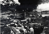
Did you know that Unalaska/Dutch Harbor was bombed by the Japanese during WWII?
-
Community
Residents/Visitors- Community Profile Economy Frequently Asked Questions History Is it Unalaska or Dutch Harbor? Passenger Transportation Photo Galleries Plants Population Shipping and Cargo Weather Wildlife WWII in the Aleutians
- Visitor Bureau Library Museum of the Aleutians Parks & Trails Passenger Transportation Sport Fishing Seasons Things To See & Do Tour Operators WWII National Historic Area and Visitor Center
- Annual Festivals and Events Community Calendar Emergency Preparedness Health Care Library Non Profits & Community Services Parks & Trails Recreation Schools Sport Fishing Seasons
Did You Know?
Did you know that Unalaska is 800 miles from Anchorage and farther West than Hawaii?
-
I want to...
Help Center- Job Board/Commission Building Permit Burn Permit Business License Fireworks Permit Pet License Staff Directory Public Records Public Safety Records Utility Service
- Utilities Taxes Voter Registration Vehicle Registration Building Code Violation Road Maintenance Issue Street Light Outage Animal Control Issues
- Agendas and Minutes Annual Budget Bids & RFPs Code of Ordinances Calendar of Meetings Community Events Documents, Reports, & Presentations Forms, Permits & Applications Property Parcel Info Schedule of Fees & Charges Mapping & GIS
Did You Know?
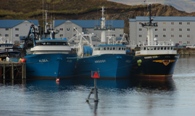
That Unalaska’s Port of Dutch Harbor is the #1 Commercial Fishing Port in the United States, based on quantity of the catch and has been for more than 25 years?
Find Out More
Mapping & GIS
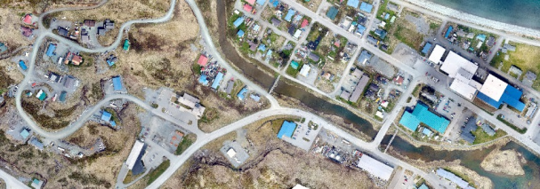
Program Mission: Creating, updating, and maintaining an advanced geospatial data management system for the purpose of advancing the City’s management of physical assets, planning for future infrastructure upgrades, and other map making needs.
Parcel Viewer
What We Do
Geographic Information Systems (GIS) is a powerful tool used to map facilities and infrastructure by creating spatial databases for the data. With these geodatabases, City staff are able to create maps for a variety of purposes and perform spatial analysis to make informed decisions about future investments. The Department of Planning is the primary point of contact for the City’s GIS with a full time staff person dedicated to maintenance and administration of the GIS. Staff members from every department are involved in doing field edits of their data and typically use the data on a day-to-day basis. Planning will continue to administer the GIS and provide training to staff members from all departments to improve the effectiveness of GIS for all City departments. GIS data includes tax parcels, addresses, zoning districts, roads, drainage systems, utility (water, wastewater, electric) networks, City buildings, and many more data useful for various City functions.